Websites
Websites
1969: The Year of Gay Liberation
[NYPL exhibit]
ABC Gotham
Fun weird NYC history, one topic for every letter of the alphabet.
A Picture History of Kew Gardens
Photos, articles, and other descriptions of the Queens neighborhood.
American Social History Project
Based at The Graduate Center, CUNY, this organization has written books, produced documentaries, created digital and online programming, and organized activities that challenge the traditional ways people learn history, for more than thirty years. They also lead professional development seminars that help teachers in NYC and across the nation use the latest scholarship, technology, and active learning methods in their classrooms.


Audubon Park Historic District
A virtual walking tour through "the neighborhood that Manhattan forgot," 155th Street to 158th Street, west of Broadway.
Before Central Park: The Life and Death of Seneca Village [NYHS exhibit]
A host of features that allow interaction with the history of the land and people that made up the pre-Civil War village of Seneca, on the upper West Side, home to many free blacks and some Irish, razed to build Central Park in 1857. Lots of good historical links, too.
Celluloid Skyline: New York and the Movies
Based on the award-winning book by architect James Sanders, this website offers multimedia and bibliography.
A project that aims to further the study of NYC English; the varieties of the language particular to the metropolitan region. The goal is to combine recent advances in speech corpus development tools with the special talents and backgrounds of CUNY undergraduates to create a database that will be a resource for all linguists. The ultimate product will be a 1-million word corpus of NYC English, with transcripts that are time-aligned with the speech signal, and fully text-searchable, with a part-of-speech tagged and parsed version of the transcripts that are searchable online
NYC’s largest collection of family-owned newspapers, websites, and magazines: Brooklyn, Queens, and the Bronx.

ENY Projects Web Hangout
Online community for those who grew up in the Linden and Boulevard House of East New York from the late 1950s to the mid-1970s.
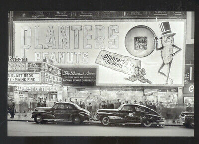
Fading Ad Campaign
Images of aged advertising in the city.
An educational and philanthropic organization founded by artisans in 1785. Sponsors a library, Mechanics Institute, small press center, and the Mossman Lock Museum.
Listing of NYC cultural events.
Gothamist
Harlem, 1900-1940 [NYPL exhibit]
A website about "everything that happens in" NYC. Now part of WNYC.
Hart Island Project
The cemetery on Hart Island occupies 101 acres in the Long Island Sound on the eastern edge of the Bronx. Since 1869, prison labor has been used to bury unclaimed and unidentified New Yorkers there in mass graves that are inaccessible to the public. Over 62,200 bodies have been deposited just since 1980. The mission of the Project is to make this cemetery, "the largest in the United States," visible and accessible. Volunteers register and enter data from pages acquired in 2008 through the Freedom of Information Act. (Older records on microfilm are at the Municipal Archives. Most burial records from May 1961 to August 1977 were destroyed in a fire set by vandals.) After the City Council introduced legislation in early 2014 to create a park where citizens could visit graves, the Project acquired new maps and added GPS data to this on-line database. The information now accompanies the tools for submitting stories and images of the buried, a collection known as the Traveling Cloud Museum, an innovative method for preserving the histories of people whose identities are erased. Hart Island is currently managed by the Department of Corrections. Visitors are confined to a small gazebo nowhere near the graves.

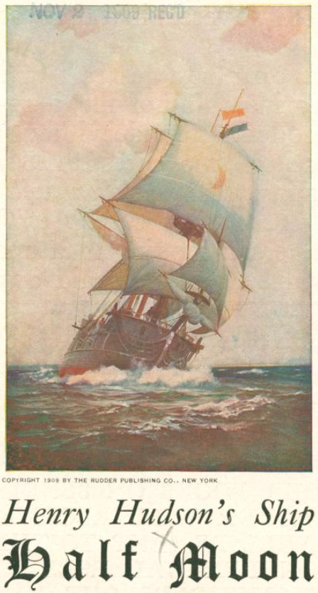
Henry Hudson 400
A collaboration with Google Maps, these interactive maps tell the story of 17th century exploration and the history of the early Dutch settlement of New York with digital mapping technology. Filled with information about Hudson's voyages, the original residents of New Amsterdam, climate change effects, commemorative events, and more.
Historical Postcards of NYC
[NYPL exhibit]
Five hundred postcards depicting all five boroughs in the late 19th and early 20th century. From the Picture Collection's holdings of more than 25,000 postcards.
History Matters
Designed for high school and college survey course teachers, this site serves as a gateway to web resources and offers unique teaching materials, first-person primary documents and threaded discussions on teaching U.S. history. Emphasizes materials that focus on the lives of ordinary Americans and actively involve students in analyzing and interpreting evidence; text, image, and audio.
History News Network
“Our mission… to help put current events into historical perspective.” Each week HNN presents up to a dozen op-eds by prominent historians, and has put out thousands over the past decade (because if “journalism is… the first draft of history… journalists traditionally have had little use for historians”).
History of NYC Parks
From the Department.

Lewis Mumford Center for Comparative Urban and Regional Research
Established at the University of Albany in 1988, to carry out urban research both comparative and historical, the tradition of interdisciplinary scholarship established by Lewis Mumford, one of the most distinguished urbanists of the 20th Century.
Lunchtime NYC [NYPL exhibit]
Looks back at more than a century of New York lunches, when the city’s early power brokers invented what was yet to be called “power lunch,” local charities established a 3-cent school lunch, and visitors with guidebooks thronged Times Square to eat lunch at the Automat.

Moving Uptown: 19th Century Views of Manhattan
[NYPL exhibit]
A large collection of images and text from the 19th century.
New Netherland Project
Established under the sponsorship of the New York State Library and the Holland Society of New York. Its primary objective is to complete the transcription, translation, and publication of all Dutch documents in New York repositories relating to the seventeenth-century colony of New Netherland. This unique resource has already proven invaluable to scholars in a wide variety of disciplines.
NYC & Company
The government's "DMO" (destination marketing organization), i.e., its tourism, convention and visitors bureau. NYC & Co. runs the Official NYC Information Center at Herald Square, which provides discounted attraction passes, guides, maps and brochures for all there is to see and do in the five boroughs, and its Research Unit is HQ for NYC travel and tourism intelligence, reporting on volume and spending, travel behavior, visitor insights, the economic impact of the industry and custom research on key NYC visitor market segments.
NYC Signs: 14th to 42nd St.
This site intends to survey all the signs in New York City from 14th to 42nd St., with an emphasis on the vintage. Earliest photographs date from the mid-1980's.
NYC Subway
A group site dedicated to the history of the system, including photos, maps, and documents.
New York Public Library - Stereograph Collection
An online digital collection of 19th century stereographs (paired photographs that appear three-dimensional when viewed through a stereoscope). Over 5000 images, many of New York.
Audio recordings and transcripts of interviews with ten influential New Yorkers: Bennett Cerf, Kenneth Clark, Mamie Clark, Moe Foner, Andrew Heiskell, Edward I. Koch, Mary Lasker, John B. Oakes, Frances Perkins, and Frank Stanton. Drawn from the Oral History Research Office at Columbia University.
More than 30,000 images from books, magazines, and newspapers - as well as original photographs, prints, and postcards - mostly created before 1923.
NYCdata
"All the information about NYC you need." A Baruch College project.
NYCityMap
This government application provides a wealth of information: locations of schools, day care centers, senior centers, libraries, hospitals, subways, and more, as well as links to Web sites for these facilities. The page is also a single-access-point to many of the numerous location-based applications on NYC.gov, such as online property, building, statistics, and census information.
Old Streets of New York: A Guide to Former Street Names in Manhattan
More than 1,600 names, no longer on the map, compiled and annotated by Gilbert Tauber. Included are old roads, lanes, alleys, courts, terraces, parks, squares, wharves, piers, slips, markets and other urban features de-mapped, obliterated, or renamed.

Pat Salmon's Blog
The private blog of the independent historian, author of several books, mainly about Staten Island.
Queens Memory Project
Combines historical and contemporary photography, maps, news clippings, and other documents with oral history interviews of current residents. A collaboration of the Queens Library Archives and Queens College Libraries’ Department of Special Collections and Archives.

Remembering the 1911 Triangle Factory Fire
[Cornell University exhibit]
Original documents on the fire, held by the University and the School of Industrial and Labor Relations, along with other useful resources.
Room Eight: New York Politics
Co-founded by Ben Smith and Gur Tsabar; the imaginary neighbor to City Hall's legendary press room, Room 9. Albany politics included.
Sepia Town
A website that gets people directly involved in their local history by uploading and mapping historical images from any location around the globe.
The Living City
[Columbia University exhibit]
A digital library initiative, meant to capture the life, health, and urban transformation of the decades between the end of the Civil War and the end of World War I.